A very dangerous hurricane has hit Mexico’s Pacific coast.
Hurricane Lidia was a very powerful storm that hit Mexico with extremely strong winds reaching up to 140mph (220km/h).
But the storm has become less strong after moving onto land, with the US National Hurricane Center (NHC) saying it is now a Category 2 storm.
Officials in the state of Nayarit reported that a man died when a tree fell on the van he was driving.
Lidia arrived at the small beach town of Las Penitas right before 6:00 PM local time (12:00 AM GMT).
The hurricane was very strong, being in category 4 out of a maximum of 5 on the hurricane wind scale.
According to the NHC, by 9:00 PM (3:00 AM GMT), Lidia had strong winds of 105 mph (165 km/h). It was passing close to the town of Mascota in Jalisco state.
The center stated that Lidia was heading towards the east-northeast at a speed of 17 mph (28 km/h). It is expected to become weaker soon as it moves over high land in west-central Mexico.
The NHC said that very strong winds from the hurricane could be dangerous to life and they are expected to happen overnight. They also warned about the water levels becoming dangerous, floods happening suddenly, and big waves on the Pacific coast.
Before the storm arrived, Mexico’s President Andrés Manuel López Obrador said that 6,000 members of the armed forces were sent to assist the people living there.
“I am telling people who live in the area between Nayarit and Jalisco, especially in Bahia de Banderas, Puerto Vallarta, and Tomatlan, to be careful,” he said on a social media website called X, which used to be called Twitter. He advises people to avoid areas that are lower in elevation, rivers, and slopes.
In Puerto Vallarta, a beach town, people stayed inside to avoid the storm. Store owners secured windows with boards and placed sandbags in case there was too much water.
The airport will be closed from 4:00 pm local time until 8:00 am on Wednesday.
Some areas of Mexico’s Pacific coastline have experienced a lot of flooding this week due to the impact of Tropical Storm Max. According to local news, two people died because of the storm in Guerrero state.
Every year, Mexico gets hit by hurricanes on both its Pacific and Atlantic coasts. The official time for hurricanes in the country is from May to November. Most hurricanes form from July to October.
Scientists are not sure yet how climate change affects the number of storms, but they believe that warmer sea temperatures make the air hotter above it and provide more energy for hurricanes, cyclones, and typhoons to form and become stronger.
Therefore, they will probably be stronger with heavier rainfall.
The Earth has gotten warmer by 1. 1C (3398F) since industry started, and it will keep getting hotter unless governments reduce emissions significantly.
Tag: Hurricane
-
Deadly hurricane makes landfall in Mexico
-
‘Extremely hazardous’ hurricane expected to develop from tropical storm Lee
The Tropical Storm Lee is going to get stronger and become a very dangerous hurricane in a few days.
The storm has started in the Atlantic Ocean and is expected to become a hurricane by Wednesday, according to the US National Hurricane Centre (NHC).
It is still too soon to know how much it will affect us, but it is not expected to reach land right now.
It is predicted that Lee will turn into a very strong hurricane. According to the NHC, the hurricane is expected to affect the Leeward Islands.
The text is saying that it is too early to know exactly where and how much impact there will be, but people in that area should keep an eye on the progress of Lee.
The wind from Lee is predicted to be very strong later in the week, reaching 145mph (233km/h). This would make it a category four hurricane.
The NHC says that a hurricane of this size could cause very serious damage if it hits land.
This happened shortly after Hurricane Idalia hit Florida, causing damage to homes and power lines. The hurricane then moved to Georgia and brought bad weather to the Carolinas. In Georgia, there were big power outages that lasted for several days. Over 200,000 people were affected by this.
The 2023 Atlantic hurricane season is expected to have more hurricanes than normal, and the strongest storms are expected to occur in about a week.
Scientists are not sure how climate change affects the number of tropical storms. However, when the ocean’s surface gets hotter, it warms up the air above it, and this extra heat energy can help make hurricanes stronger.
Therefore, they will very likely become stronger and have heavier rainfall. -

Hurricane Hilary diminishes, but still poses a threat to life in the US
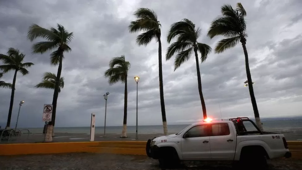
Meteorologists from the United States have issued a warning regarding Hurricane Hilary, which has undergone a weakening process as it advances towards the Pacific coast of Mexico and California.
Although its strength has diminished, the potential for causing “life-threatening” flooding remains a concern.
With sustained winds now reaching 85 mph (140 km/h), the storm has been reclassified as a Category 1 hurricane. During the previous night, substantial rainfall affected regions of Mexico’s Baja California peninsula and the southwestern United States.
Tragically, in Baja California, an individual lost their life when they were carried away while attempting to cross a stream.
This person had been traveling in a vehicle with their three children (aged 7, 15, and 22) and another woman. Fortunately, the other occupants of the vehicle survived the incident, according to reports from local media.
The current trajectory predicts that Hilary will further weaken into a tropical storm before making its way to southern California. This occurrence would mark the first time a tropical storm has made landfall in the state in over eight decades.
As of the most recent update provided at 06:00 GMT on Sunday, the US National Hurricane Center’s report indicates that the hurricane is situated approximately 90 miles (145 km) to the south of Punta Eugenia, which is the westernmost point of Baja California.
Hilary’s centre will “move close to the west-central coast of the Baja California Peninsula” on Sunday morning and will then move across southern California on Sunday afternoon, the NHC said.
“Hilary appears to be weakening quickly,” John Cangialosi, a senior hurricane specialist at the NHC, was quoted as saying by the Associated Press news agency on Saturday.
“The eye is filling and the cloud tops in the eyewall and rainbands have been warming during the past several hours,” he adds.
Hilary was earlier a powerful Category 3 storm with winds up to 130mph.
Rainfall could reach 10in (25cm) in some areas of southern California and southern Nevada, the NHC says. “Dangerous to catastrophic flooding is expected,” it adds.
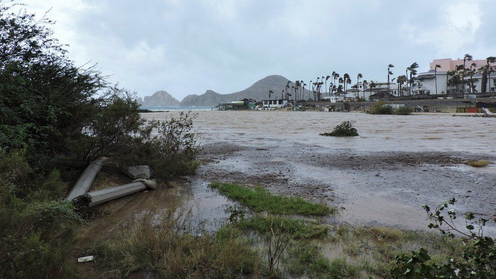
Image caption,Heavy rain and winds hit Cabo San Lucas in Baja California, Mexico, on Saturday In San Diego, the National Weather Service (NWS) earlier issued a warning for the “high potential” of flash flooding. Nearly 26 million people in the south-western US were under flood watch.
On Friday, US President Joe Biden said that the Federal Emergency Management Agency (Fema) had “pre-positioned personnel and supplies in the region”.
“I urge everyone in the path of the storm to take precautions and listen to the guidance from state and local officials,” he said.
Parts of Mexico are under a tropical storm watch and its government has placed 18,000 soldiers on standby to assist in rescue efforts.
As the storm bears down, Major League Baseball has rescheduled three games in southern California, while SpaceX has delayed the launch of a rocket from its base on the central California coast until at least Monday.
The National Park Service also closed Joshua Tree National Park and Mojave National Preserve, both in California, to prevent visitors from being stranded in the event of flooding.
- Wildfires engulf Canada homes as evacuation quickens
- ‘Apocalyptic’ scenes as Canadians flee wildfires
Local officials in cities across the region, including in Arizona, are offering sandbags to residents seeking to safeguard their properties against potential floodwaters.
Hurricanes and tropical storms are somewhat common in Mexico. But the last time a tropical storm made landfall in southern California was in Long Beach in 1939.
Experts say the abnormal weather events plaguing the US – and several areas across the globe – are being influenced by human-caused climate change.
In the wake of the hottest month on record, July 2023, according to Nasa, the deadliest wildfire in modern US history spread across Hawaii on 8 August, killing at least 111 people.
The damage was escalated by hurricane winds passing through the area.
-
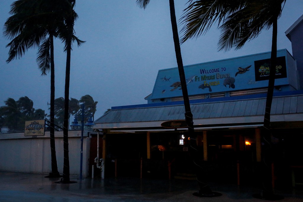
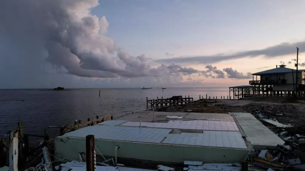
‘The worst storm surge I’ve ever seen’ – Hurricane Ian devastates Fort Myers
Less than 24 hours after the hurricane made landfall, I’m standing with Pastor James Macon from the city’s River Church, assessing the devastation. Fort Myers was directly in the line of the hurricane.
Boats are piled on top of one another at the marina, pieces of the floating harbour have been forced inland, and the area is covered with muck and trash.
“I’ve never seen anything like this in all my years in Florida. I’ve been here since 1982 and I’m lost for word right now,” he tells me.
“This is, wow.”
Pastor James says he’s been driving around looking for people in need of help and he’s particularly worried about homeless people who might have been out last night.
But while he’s aware that much of the damage here in the marina is likely to impact a different end of society, he says everyone needs help.
“This neighbourhood, of course, they’re pretty well off, but we’re here to help them out.”
Lee county, the area that surrounds Fort Myers took the brunt of the storm surge.
There’s been suggestions from the local sheriff, Carmine Marceno, that – in outlying island communities – particularly where they’re hard to access as a result of at least one destroyed bridge and a damaged causeway – the authorities fear they could yet find a significant loss of life.
But so far, there’s been no official confirmation of that claim and, in a later interview, Mr Marceno was more cautious.
“I don’t know the exact numbers, it’s very preliminary,” he told CNN.
The hurricane quickly lost power as it barrelled into the gulf side of the Florida peninsular and though heavy rain continued to pose a risk of flooding, the wind speed quickly dropped.
Fort Myers in particular though will be counting the cost for some time.Patrick Hallquist was at home when the hurricane struck and says he’s never seen anything this bad.

“I’ve been in quite a few hurricanes and this is the worst storm surge I’ve ever seen”, he tells me.
“It was a little bit anxiety-ridden,” he adds.
Despite the devastation, many here feel they’ve had a lucky escape from a hurricane that fits a pattern of increasingly powerful storms, thought to be fuelled in part by man-made global warming.
Pastor James says he’s so far seen no evidence of a large number of casualties.
“I have a lot of friends around here, I’ve visited their houses and so far, so good,” he tells me.
“By the grace of God, we did endure this thing.”
-
Hurricane Ian :Roof tearing off and flying away
Before the hurricane even made landfall, powerful winds have been causing destruction in Florida.
Watch this from Cape Coral…
Hurricane #Ian doing damage in Cape Coral, Florida.pic.twitter.com/dWUEJFWKLn
— Moshe Schwartz (@YWNReporter) September 28, 2022
-
‘Life-threatening’ As Hurricane Ian approaches the Florida coast
The storm has maximum winds of 155 mph as it moves toward Florida’s southwest coast, falling just short of the most severe Category 5 status.
Authorities have issued dire warnings about catastrophic storm surges that might cause the water to rise up to 12 feet or 16 feet above ground in some places.
More than 2.5 million people are under mandatory evacuation orders, although some have chosen not to flee or are unable to.
Residents have rushed to board up their homes and stash precious belongings on upper floors.
Severe winds and rain have already begun to lash the American state’s heavily populated Gulf Coast.
The massive storm is expected to slam into the Gulf Coast somewhere north of Fort Myers and some 125 miles south of Tampa.
Florida governor Ron DeSantis warned at a news conference: “This is the kind of storm surge that is life-threatening.”
“It is a big storm, it is going to kick up a lot of water as it comes in,” he said from Sarasota, a coastal city of 57,000 in the storm’s projected path.
-
Hurricane Ian: Nasa forced to shelter Artemis Moon rocket
Due to an impending hurricane, the American space agency will remove its Artemis-I Moon rocket from the launch pad in Florida.
In order to preserve it, NASA says that the Space Launch System (SLS) vehicle will be rolled back into its engineering workshop.
Hurricane Ian is moving through the Gulf of Mexico and is expected to make landfall in Florida on Thursday.
High winds and heavy rain are forecast for the Kennedy Space Center.
Although the spaceport will probably escape the worst of the storm’s impacts, Nasa can’t risk its multi-billion-dollar rocket being damaged.
The return to Kennedy’s famous Vehicle Assembly Building (VAB) likely now moves the maiden flight of the SLS to November.
Nasa had hoped the storm’s track through the Gulf would take it sufficiently westwards so that the rocket could stay out on the pad, enabling a lift-off to take place sooner.
But the medium-range forecast models have, in recent hours, seen the expected track shift eastwards, putting the west coast of Florida, or its panhandle, directly in the firing line.
Florida Governor Ron DeSantis has already declared a “state of emergency”.
Nasa has one of its giant tractors on standby at the pad, ready to initiate the roll-back.
The slow speed at which this Crawler Transporter moves means the 6.7km (4.2 miles) journey to the VAB takes the best part of half a day. Engineers will therefore want to get it underway as soon as possible.
The retreat is expected to begin at 0400BST (2300EDT).
Artemis-I is the first in a series of missions that will eventually see humans return to the lunar surface after an absence of 50 years.
The initial flight of the SLS is uncrewed: it’s billed as a safety demonstration of the hardware and will send a capsule called Orion out to and beyond the Moon before coming home to a splashdown in the Pacific Ocean.
Assuming everything works as it should, astronauts will then climb aboard the next scheduled SLS-Orion outing in 2024. This again will do a simple loop around the Moon.
It’s on Artemis-III, possibly in late 2025, that astronauts will make the trip down to the lunar surface.