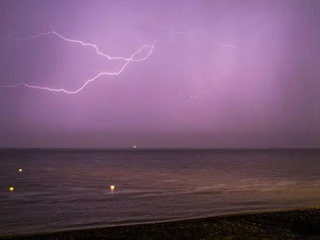
Meteorologists from the United States have issued a warning regarding Hurricane Hilary, which has undergone a weakening process as it advances towards the Pacific coast of Mexico and California.
Although its strength has diminished, the potential for causing “life-threatening” flooding remains a concern.
With sustained winds now reaching 85 mph (140 km/h), the storm has been reclassified as a Category 1 hurricane. During the previous night, substantial rainfall affected regions of Mexico’s Baja California peninsula and the southwestern United States.
Tragically, in Baja California, an individual lost their life when they were carried away while attempting to cross a stream.
This person had been traveling in a vehicle with their three children (aged 7, 15, and 22) and another woman. Fortunately, the other occupants of the vehicle survived the incident, according to reports from local media.
The current trajectory predicts that Hilary will further weaken into a tropical storm before making its way to southern California. This occurrence would mark the first time a tropical storm has made landfall in the state in over eight decades.
As of the most recent update provided at 06:00 GMT on Sunday, the US National Hurricane Center’s report indicates that the hurricane is situated approximately 90 miles (145 km) to the south of Punta Eugenia, which is the westernmost point of Baja California.
Hilary’s centre will “move close to the west-central coast of the Baja California Peninsula” on Sunday morning and will then move across southern California on Sunday afternoon, the NHC said.
“Hilary appears to be weakening quickly,” John Cangialosi, a senior hurricane specialist at the NHC, was quoted as saying by the Associated Press news agency on Saturday.
“The eye is filling and the cloud tops in the eyewall and rainbands have been warming during the past several hours,” he adds.
Hilary was earlier a powerful Category 3 storm with winds up to 130mph.
Rainfall could reach 10in (25cm) in some areas of southern California and southern Nevada, the NHC says. “Dangerous to catastrophic flooding is expected,” it adds.
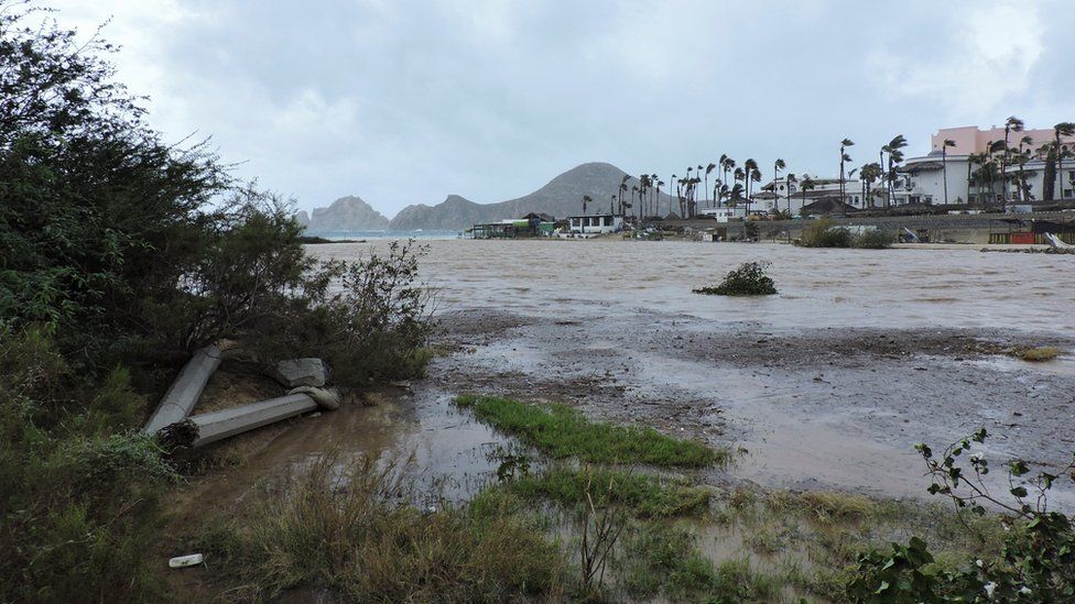
In San Diego, the National Weather Service (NWS) earlier issued a warning for the “high potential” of flash flooding. Nearly 26 million people in the south-western US were under flood watch.
On Friday, US President Joe Biden said that the Federal Emergency Management Agency (Fema) had “pre-positioned personnel and supplies in the region”.
“I urge everyone in the path of the storm to take precautions and listen to the guidance from state and local officials,” he said.
Parts of Mexico are under a tropical storm watch and its government has placed 18,000 soldiers on standby to assist in rescue efforts.
As the storm bears down, Major League Baseball has rescheduled three games in southern California, while SpaceX has delayed the launch of a rocket from its base on the central California coast until at least Monday.
The National Park Service also closed Joshua Tree National Park and Mojave National Preserve, both in California, to prevent visitors from being stranded in the event of flooding.
- Wildfires engulf Canada homes as evacuation quickens
- ‘Apocalyptic’ scenes as Canadians flee wildfires
Local officials in cities across the region, including in Arizona, are offering sandbags to residents seeking to safeguard their properties against potential floodwaters.
Hurricanes and tropical storms are somewhat common in Mexico. But the last time a tropical storm made landfall in southern California was in Long Beach in 1939.
Experts say the abnormal weather events plaguing the US – and several areas across the globe – are being influenced by human-caused climate change.
In the wake of the hottest month on record, July 2023, according to Nasa, the deadliest wildfire in modern US history spread across Hawaii on 8 August, killing at least 111 people.
The damage was escalated by hurricane winds passing through the area.